

That's Gneiss! #68 ~ You've overstayed your welcome snow
That's Gneiss! #68 ~ You've overstayed your welcome snow
I’m not quite sure how, but we survived the move.
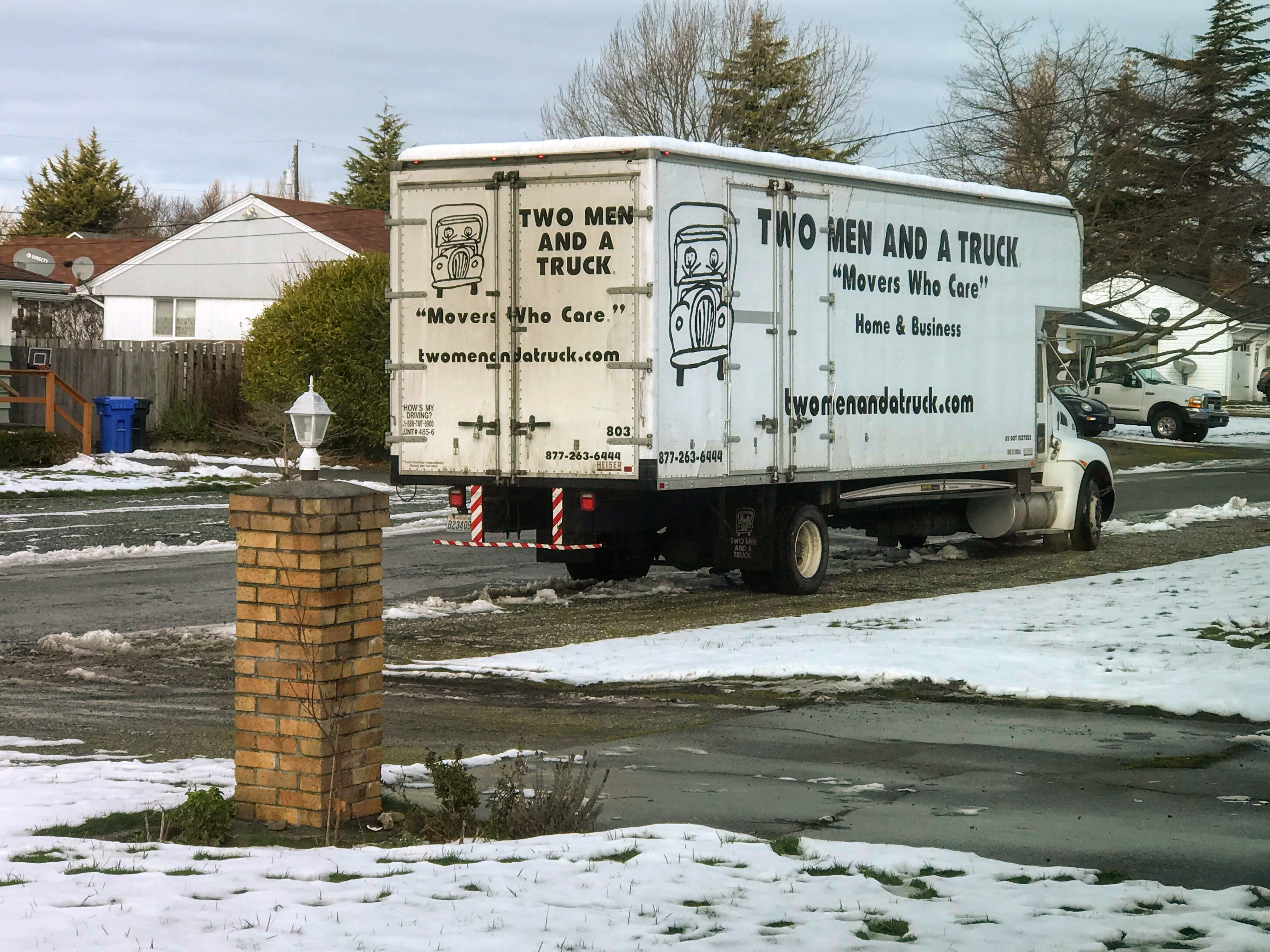
The day before we planned to move, our street looked like this:

We get snowstorms of this magnitude only every few years, so it just figures we’d get one the week we planned to move. The next morning the movers called, and postponed a day. Frustrating, but totally understandable. We got more done around the house, and I walked around a lot with the dog, looking at the icy wasteland and attempts at making snow people.

The movers made it on Wednesday, which was looking much better by then. The sight of that truck pulling up was my happiest moment in days. The movers did a great job (it was actually three men), especially mucking around in the snow. When we arrived at our new home, we discovered that there was indeed a lot more snow than we had received on north Whidbey.

It still hasn’t all melted, but it’s almost gone. I was so happy a couple of days ago when I didn’t need to wear boots anymore while taking the dog for his walk. And speaking of walking, there are so many possibilities for our daily walks! We haven’t even started exploring the alleys yet, as the snow hasn’t completely melted and they look pretty muddy. Yesterday we explored the area on the east side of I-5, and I can tell that’s going to be one of our favorite places to walk.
Now that we’re here, the fun begins! We’ve started shamelessly shopping the IKEA website and putting together our lists of things that we want. We’re both looking forward to setting up our creative spaces, and there’s a few other things we need. Next weekend we’ll be venturing south to visit IKEA in person. I haven’t been there since Nolan was a very small child!
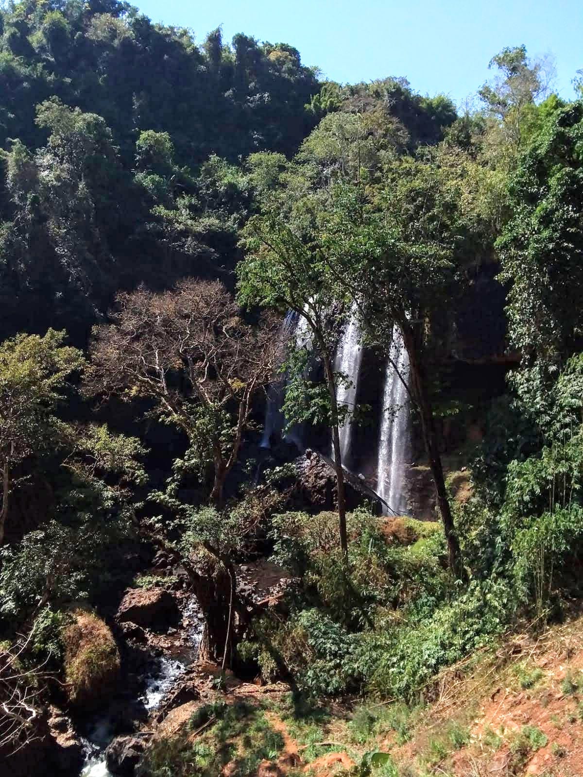
Speaking of Nolan (because I’m sure you’ve read enough about our move), he and Mia are now traveling in Laos. They’ve only sent one photo of some waterfalls at Tad Tayicseua, on the Bolaven Plateau. It looks amazing! I’m a bit envious of that lush greenery.
I’m really looking forward to life returning to some semblance of normalcy. It’s back to work on Tuesday, when I begin my now very short commute! The days are getting longer, and we’ll soon be done with the cold weather. I’m ready for spring!
Have a good week!
~Anne
Tidbits
Immerse yourself in Dada - digital archives of Dadaist periodicals and other publications
These places aren’t “broken” or “blemished” - they’re the beautiful results of natural processes (sheesh)
Drowned Cities - what will some of the largest cities in the U.S. look like when the sea level rises? (via N.H.)
Visualizing the complexities of place - the Dialectograms of Mitch Miller (via N.H.)
When you want to enjoy historical maps but can’t make it in person (via N.H.)
Some people draw with colored pencils, others build guitars! (via H.P.)
Reading: yeah, right. Maybe next week!
Making: plans for my craft room
Recently eaten: we’re happy to be getting back to home-cooked food. Last night it was potato leek soup, tonight it will be salmon!
Video of the Week
I was reminded yesterday of one of my favorite videos of cars trying to navigate an icy hill in Seattle, circa 2010. This folks is why Seattle and the surrounding areas come to a screeching halt when it snows.
If you enjoy watching such things, here are many more! Take pleasure in the woes of others. If you have ever been in a car on an icy slope of even a few degrees, you will understand the terror.
Question of the Week
Just hit reply to send your answer, and I’ll share it next week. Always anonymous!
What are you reading these days?
~~~~~~~~~~~~~~~~~~~~~~~~~~~~~~~~
Last week I asked whether you prefer paper or digital maps.
I like paper maps to look at. I like digital maps for commutes.
I’m bi-mapual. Both. The paper are classic and beautiful usually. Basically works of art. Even the hand drawn ones on napkins. Digi maps are beautiful too but more in a functional way. The info and links are fantastic. Some get too cluttered and that makes me kind of want to give up on those. The well designed app maps are best. All this said, I’m super happy I can read a hand held paper map and navigate with them. It’s becoming a lost art.
Currently it's all digital all the time, but as someone who used to make maps (in a colloquial cartography-kind of way), physical media still holds a place in my heart. If it weren't for digitization, I'd likely be in the Central Library's Maritz Map Room a lot more. https://www.spl.org/hours-and-locations/central-library/central-library-highlights/map-room
Paper maps in our house. Mike and Quinton are always looking for new ways to get here and there and really hate to use GPS. I myself love maps, but have gotten spoiled with GPS. I really wonder how we ever got anywhere without GPS and MapQuest. We actually had to get directions from someone when we got lost or couldn't find the place where we were going.
I love paper maps. My father taught me how to read a map when I was about 8 years old, and I have been fascinated by them ever since. I was the family navigator on many a cross-country trip, and I could tell you where every rest stop was between Alameda and Virginia Beach.
I still prefer paper maps. My most recent purchase was the BundesländerKarte for Bavaria - because I couldn’t bear traveling in the back seat without knowing exactly where I was at any given moment. This map comes with a separate 93-page index, where you’ll find the legend, transit route maps, and detailed city maps. Wowee! Incidentally, the German word for index is Registerheft.
As for digital maps, while I don’t completely trust them, I have to admit they come in handy. There’s no denying they can be updated far more quickly than their paper counterparts.
So, I guess I’m a braces and belt sort of person. I am not averse to using digital maps, but I like to have a paper map, just in case. You never know when you might be directed to drive through the Pacific Ocean or whatnot.
Re. maps, I'm very much a fan of paper. For one thing, living in the remote California desert for the last five years, we met tons of terrified tourists knocking on our door hoping for gas and advice. Their digital map technology were telling them the way from Las Vegas to Yosemite, but neglected to mention that there would be no services for a 150-mile stretch. More broadly, digital maps seem to be all about efficiency, getting the job done, reaching destinations. Paper maps are are for wandering, inspiration, daydreaming, finding scenic routes and long-cuts, noticing unexpected relationships in geography or intriguing place names one would never track down on purpose. Well-used maps are guidebook, encyclopedia, postcard and souvenir all in one.
I love the artistic potential of paper maps, and the joy of letting my eyes wander and discover new things. Digital maps are useful for figuring out how to get somewhere and determining how bad traffic is along the way. If I had to choose one, I’d take paper over digital any day.
From the closest weather station until I get mine set up:
Current Temperature: 38 F (3 C)
Current Humidity: 99%
Wind Gusts: 4 mph
Precipitation: 0.01 in
Number of Subscribers: 96